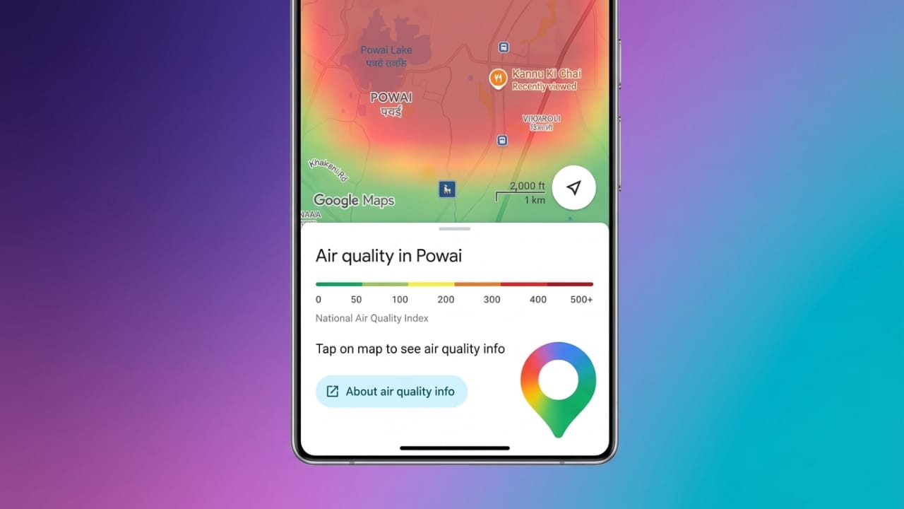
Air pollution has become a major concern in many cities, especially during the winter season. Smog, dust, and vehicle emissions can significantly affect air quality and make outdoor activities uncomfortable or even risky for some people.
To help users stay informed, Google Maps provides real-time Air Quality Index (AQI) information. This feature allows you to check pollution levels in your area or any location before stepping outside.
Also read: WhatsApp Plus: Features, Price, Availability, and Everything You Should Know
Why Checking AQI Matters
Poor air quality can affect everyone, but children, senior citizens, and people with respiratory conditions are usually more vulnerable. High pollution levels may lead to breathing difficulties, eye irritation, and general discomfort.
By checking AQI before leaving home, you can make better decisions about travel, exercise, or other outdoor activities. Real-time updates help you avoid heavily polluted areas and choose safer times to go outside.
What Is the AQI Feature in Google Maps?
Google Maps includes an Air Quality layer that displays current air pollution conditions directly on the map. Instead of installing a separate app, users can view AQI information within Google Maps on both smartphones and desktop browsers.
The feature is available in many countries and provides regularly updated air quality data, making it easier to monitor environmental conditions throughout the day.
Understanding AQI Colors on Google Maps
Google Maps uses color-coded indicators to make air quality information easy to understand.
- Green – Good air quality with minimal pollution.
- Yellow – Acceptable air quality for most people.
- Orange – Moderate pollution; sensitive individuals should take precautions.
- Red – Unhealthy air quality that may affect many people.
- Dark Red or Maroon – Very unhealthy or severe pollution levels.
These colors help users quickly understand air conditions without needing to interpret complex numbers.
Benefits of Using AQI on Google Maps
The AQI feature offers several advantages:
- Provides real-time air quality information.
- Helps users plan safer outdoor activities.
- Works on smartphones and computers.
- Uses simple color indicators for easy understanding.
- Allows comparison of pollution levels in different locations.
- Helps families make informed travel and outdoor decisions.
- Available at no additional cost.
How to Check AQI on Google Maps
Checking air quality through Google Maps is simple and takes only a few minutes.
Step 1: Update Google Maps
Open the Google Play Store or Apple App Store and make sure Google Maps is updated to the latest version. Updated apps usually offer better performance and access to the latest features.
Step 2: Open Google Maps
Launch the Google Maps application on your device and wait for the map to load completely.
Ensure your internet connection is active so the latest AQI data can be displayed.
Step 3: Search for a Location
Use the search bar to enter the name of a city, neighborhood, road, market, or any location you want to check.
Google Maps will display the selected area on the screen.
Step 4: Open the Layers Menu
Look for the Layers icon on the map interface. It usually appears as a stack of squares or layers.
Tap the icon to open additional map settings.
Step 5: Select Air Quality
From the available options, choose Air Quality.
Google Maps will now show color-coded air quality information across the selected area.
Step 6: View Detailed AQI Information
Zoom in on specific neighborhoods or locations to see more detailed air quality data.
You can tap different areas on the map to check pollution levels and understand how air quality varies across nearby locations.
Helpful Tips for Using AQI Data
To get the most benefit from the AQI feature:
- Check air quality before morning walks or workouts.
- Limit outdoor exercise when pollution levels are high.
- Consider wearing a mask in heavily polluted conditions.
- Keep children indoors during severe pollution periods when possible.
- Review AQI before planning outdoor events or travel.
- Check updates regularly, as conditions may change throughout the day.
Understanding AQI Levels
The Air Quality Index typically ranges from 0 to 500. Lower values indicate cleaner air, while higher values suggest increasing pollution levels.
AQI 0–50: Good
Air quality is considered healthy, and outdoor activities can generally be enjoyed without concern.
AQI 51–100: Satisfactory
Air quality remains acceptable for most people, although highly sensitive individuals may experience minor discomfort.
AQI 101–200: Moderate
Some people, particularly children, older adults, and those with respiratory issues, may want to reduce prolonged outdoor exposure.
AQI 201–300: Poor
Air pollution levels may begin affecting a larger number of people. Limiting outdoor activity is advisable.
AQI 301–400: Very Poor
Outdoor exposure should be minimized where possible, especially for sensitive groups.
AQI 401–500: Severe
Air quality is considered hazardous. People should avoid unnecessary outdoor activities and follow local health advisories when available.
Also read: How to Send WhatsApp Messages Without Saving a Contact on Android and iPhone
Final Thoughts
Google Maps has made it easier than ever to stay informed about air pollution levels. With its built-in AQI feature, users can quickly check air quality, compare nearby locations, and make smarter decisions about outdoor activities.
Whether you’re planning a morning walk, commuting to work, or organizing a family outing, checking AQI on Google Maps can help you stay aware of current air conditions and plan accordingly.

Jatin Rajput (Tech Golu) — Tech blogger & YouTuber with 6+ years of experience in WhatsApp, Instagram, Facebook, and mobile guides. Founder of TechGolu.in.